|
Dale Stenseth's Alabama High Point Page
| |
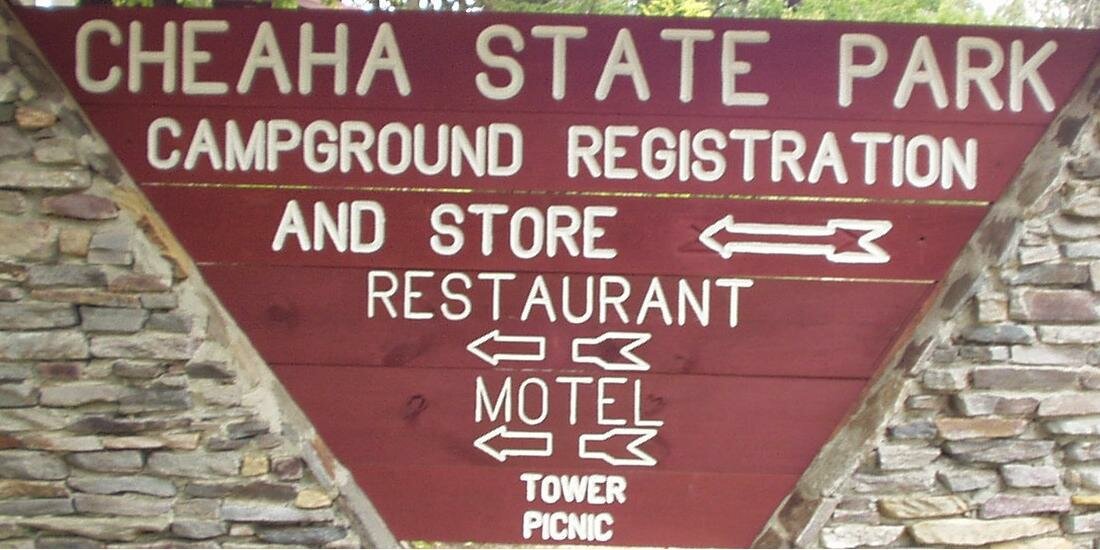
Highpoint 31. Alabama, Cheaha Mountain, 2407 ft, 9/21/2003 Used Wingers' book for guidance.
Zumwalt's book contains an area topographical/road map.
There are 3 roads up the mountain. (2 ways on State 281, plus a road that connects to 281) If you are coming from the south, (like from the Florida highpoint) you can save about 40 miles by taking a cut-off from State 21, north of Talladega. This route is not as easy to follow as the more commonly used route from I20 on the north.
The tower has an internal staircase, which you can climb to the top.
There are rest rooms near the gate area.
Survey benchmarks are shown below. |
|
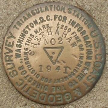
The station survey mark is the 'X' mark on the floor of the building, inside the stairwell. At the time the building was constructed, around 1939, the construction engineer recovered the original 1886 CGS mark. He plumbed the 'X' mark on the floor above the original mark.
Benchmark Information from the NGS Data Sheet:
Designation - CHEEHAHAW
PID - DG3595
State/County - AL/CLEBURNE
USGS QUAD - CHEAHA MOUNTAIN (1976)
NAD 83(1992)
Lat --- 33 29 07.84060(N)
Long -- 085 48 31.18698(W) ADJUSTED
Height - "2413" feet ADJUSTED
There are other benchmarks nearby.
This is descriptive information
only and not for navigation. |
 |
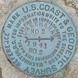
The following marker is in the stone walkway behind me in the picture above.
Benchmark Information from the NGS Data Sheet:
Designation - CHEEHAHAW 2
PID - DG1675
State/County - AL/CLEBURNE
USGS QUAD - CHEAHA MOUNTAIN (1976)
NAD 83(1992) -
Lat --- 33 29 07.48213(N)
Long -- 085 48 30.82064(W) ADJUSTED
Height - 2405.52 feet ADJUSTED
There are other benchmarks nearby.
This is descriptive information
only and not for navigation. |
 |
The following marker is in a large stone on the left end of the building that extends under the building.
Benchmark Information from the NGS Data Sheet:
Designation - CHEEHAHAW 2 RM 2
PID - DG1676
State/County - AL/CLEBURNE
USGS QUAD - CHEAHA MOUNTAIN (1976)
NAD 83(1986)
Lat --- 33 29 07. (N)
Long -- 085 48 30. (W) SCALED
Height - 2407.16 feet ADJUSTED
There are other benchmarks nearby.
This is descriptive information
only and not for navigation. |
 |
Note the motel and restaurant near the summit.
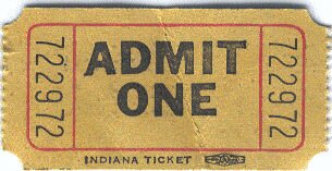
There is a $1 fee per person to get through the gate, when the ranger is present.
The ranger will give you a ticket like this.
Copyright © 2003-2006 Dale Stenseth. All rights reserved.
This page may be freely linked to, but may not be duplicated in any manner without the author's express consent,
except that hikers may print a single copy of trip reports for personal use.
|