|
Dale Stenseth's Minnesota High Point Page
| |
6. Minnesota, Eagle Mountain, 2301 ft, 4/11/03
Used Winger's book for guidance.
Zumwalt's book was also helpful and contains an adequate topographical map. Use Route 2.
Made the round trip from Minneapolis, and hike all in one long day. It was a wonderful spring day. There was still snow on much of the trail, and it was very icy in some places. Had to 'duck walk' to keep from falling. There were no mosquitos or black flies, wood ticks or deer ticks, so no Lyme disease or West-Nile virus. With the icy spots, the hike took 3 hours, 45 minutes round trip, from the trailhead. The top is rounded, with trees and brush growing, so there is no view at all. About 200 yards before the summit, there is a good lookout to the west.
Special thanks to the Kekekabic Hiking Club for the trail maintenance they do, which makes this hike moderate instead of difficult. See the sign information and trail guide below.
There were no rest rooms at the trailhead or summit.
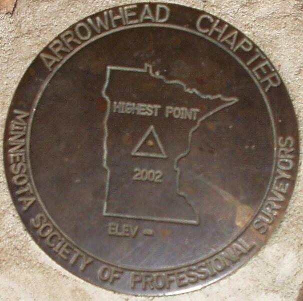
A survey marker is shown below. |
|
 |
The survey marker below is set in cement on the back side of the plaque shown above.
Benchmark Information:
Designation - HIGHEST POINT 2002 ELEV -
MINNESOTA SOCIETY OF PROFESSIONAL SURVEYERS
ARROWHEAD CHAPTER
PID -
State/County - MN/COOK
Lat --- 47 53 51(N)
Long - 090 33 36(W)
This is descriptive information
only and not for navigation. |
 |
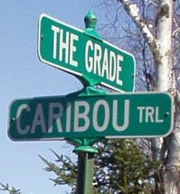
Traveling northeast on Hwy 61, 4 miles past Tofte, turn left at these signs.
Continue north on Caribou Trail until you arrive at a tee with the following sign. Turn right on to 'The Grade'.
Same intersection, street sign on southeast corner.
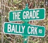
From 'The Grade', turn left into the trailhead parking lot at this sign.
Same intersection fire department number sign.
Same intersection, Distance sign.
Same Intersection, southeast corner street sign.
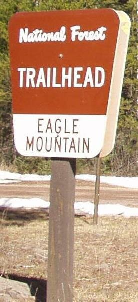
Information Sign at Trailhead.
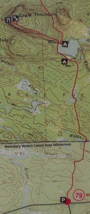
Part of Posted Trail Map.
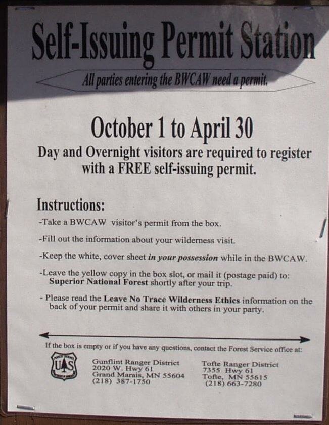
Self Issue Permit Notice.
Copyright © 2003-2006 Dale Stenseth. All rights reserved.
This page may be freely linked to, but may not be duplicated in any manner without the author's express consent,
except that hikers may print a single copy of trip reports for personal use.
|